
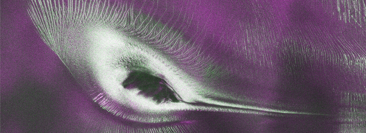
India-U.S. Satellite Captures Antarctic Landscape Resembling Hummingbird
Satellite Imagery Reveals Unique Antarctic Formation Echoing a Hummingbird
Recent imagery captured by the NISAR satellite, a collaborative project between NASA and the Indian Space Research Organisation (ISRO), has unveiled a large, bird-like geographical feature in Antarctica. This formation, which resembles a hummingbird, was identified during the satellites routine observations of Earths surface and adds to our understanding of this remote region.
Launched in early 2023, the NISAR satellite is equipped with advanced radar technology designed to monitor changes in ecosystems, land use, and the impacts of climate change over time. The satellites ability to capture both optical-light images and radar data enables researchers to analyze surface patterns and features that are difficult to see with traditional imaging.
The phenomenon identified as a “hummingbird” is not a biological entity but rather a result of natural geological processes, including the erosion and movement of ice and other materials. Such satellite findings are significant as they help scientists track environmental and climate-related changes in the Antarctic region.
Experts emphasize that understanding the landscape of Antarctica is crucial, as it plays a vital role in global climate regulation and can provide insights into rising sea levels that affect coastal cities worldwide. Continued monitoring through initiatives like NISAR is expected to yield valuable data for climate research and environmental preservation efforts.
As the NISAR satellite continues its mission, more such formations may be discovered, further contributing to our knowledge of Earths landscapes and the effects of climate change.